Eagle County Colorado Map
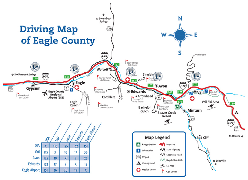
- <--- Eagle County is approximately 60 miles wide along I-70 --->
National Forest and Bureau of Land Management lands comprise
approximately 80% of Eagle County’s land area.
- Arrowhead – between Avon and Edwards, S of I-70 – Google Map
Avon – on I-70 mm 167 – Map
Bachelor Gulch – immediately SW of Avon – Map
Beaver Creek – immediately S of Avon – Map
Booth Creek – just E of Vail Golf Course, N side of I-70 – Map
Cordillera – immediately W of Edwards, along Squaw Creek
Cotton Ranch – immediately S of Gypsum – Map
Eagle – on I-70 at mm 149 – Map
Eagle Ranch – immediately S of Eagle – Map
EagleVail – between Avon and Vail – Map
Edwards – on I-70 at mm 163 – Map
Gypsum – on I-70 at mm 141 – Map
Homestead – immediately S of Edwards – Map
Lake Creek – SW of Edwards – Map
Lionshead – 1/2 mile W of Vail Village – Map
Mountain Star – immediately N of Avon – Map
Singletree – immediately N of Edwards – Map
Vail – 90 miles W of Denver, I-70 mm 176 – Map
Wildridge – immediately N of Avon – Map
For Maps that can Zoom In or Zoom Out see …
Maps.Google.com